


08 Holly Grove Voting District, Haywood County, Tennessee
About
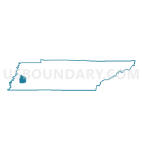
Outline

Summary
| Unique Area Identifier | 668815 |
| Name | 08 Holly Grove Voting District |
| County | Haywood County |
| State | Tennessee |
| Area (square miles) | 40.26 |
| Land Area (square miles) | 40.18 |
| Water Area (square miles) | 0.09 |
| % of Land Area | 99.78 |
| % of Water Area | 0.22 |
| Latitude of the Internal Point | 35.63921510 |
| Longtitude of the Internal Point | -89.12526960 |
Maps


Graphs
Select a template below for downloading or customizing gragh for 08 Holly Grove Voting District, Haywood County, Tennessee


Neighbors
Neighoring Voting District (by Name) Neighboring Voting District on the Map
- 02 Parks & Recreation Dept Voting District, Haywood County, TN
- 03 Courthouse Voting District, Haywood County, TN
- 06 Tibbs Voting District, Haywood County, TN
- 07 Wyatt-Duke National Guard Armory Voting District, Haywood County, TN
- 10 Voting District, Crockett County, TN
- 10 Union Voting District, Haywood County, TN
- 11 Voting District, Crockett County, TN
- 7-2 Tennessee Technology Center Voting District, Madison County, TN
Top 10 Neighboring County Subdivision (by Population) Neighboring County Subdivision on the Map
- District 7, Madison County, TN (7,159)
- District 7, Haywood County, TN (2,263)
- District 2, Haywood County, TN (2,048)
- District 6, Haywood County, TN (1,917)
- District 3, Haywood County, TN (1,807)
- District 5, Haywood County, TN (1,799)
- District 11, Crockett County, TN (1,245)
- District 10, Crockett County, TN (932)
Top 10 Neighboring Place (by Population) Neighboring Place on the Map
Top 10 Neighboring Elementary School District (by Population) Neighboring Elementary School District on the Map
Top 10 Neighboring Secondary School District (by Population) Neighboring Secondary School District on the Map
Top 10 Neighboring Unified School District (by Population) Neighboring Unified School District on the Map
- Jackson-Madison Consolidated School District, TN (98,294)
- Haywood County School District, TN (18,787)
Top 10 Neighboring State Legislative District Lower Chamber (by Population) Neighboring State Legislative District Lower Chamber on the Map
- State House District 82, TN (60,783)
- State House District 81, TN (58,581)
- State House District 80, TN (54,808)
Top 10 Neighboring State Legislative District Upper Chamber (by Population) Neighboring State Legislative District Upper Chamber on the Map
Top 10 Neighboring 111th Congressional District (by Population) Neighboring 111th Congressional District on the Map
Top 10 Neighboring Census Tract (by Population) Neighboring Census Tract on the Map
- Census Tract 9304, Haywood County, TN (4,059)
- Census Tract 9614, Crockett County, TN (3,821)
- Census Tract 9303.02, Haywood County, TN (2,926)
- Census Tract 9301, Haywood County, TN (2,811)
- Census Tract 17, Madison County, TN (1,620)